
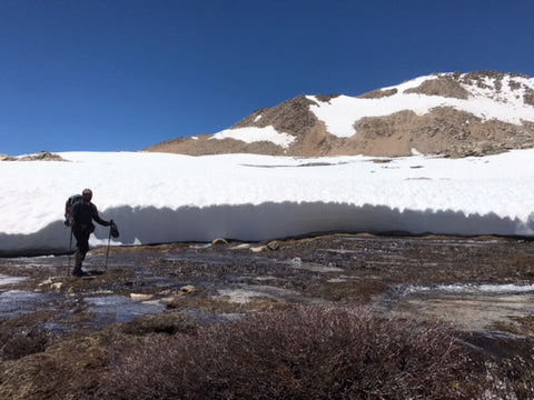
White Pirate in the Southern Sierra this past week
The Sierra snow will be gone from most of the trail before you know it! Here's some info that will hopefully help you and your group move forward more easily no matter what section of trail you are on.
SNOW STATS (from Postholer.com):
- Kennedy Meadows to Echo Lake/South Lake Tahoe – 394 miles - 23% is still snow covered. So as you can see it's gone down drastically from my previous report. I don't have any more specifics unfortunately. From all the pictures I've looked at, I know there's still a LOT of snow from the Bishop area north. Lots of snow.
TRAIL CONDITIONS
~ Kennedy Meadows to Lone Pine – No snow on trail
~ Lone Pine to Kearsarge Pass – The peak snowmelt has passed but water levels are still on the high side. I've heard it's possible to cross every creek safely if you walk upstream 1-2 miles. Most you don't have to go that far. But if you bring enough food to allow yourself the time to do it, you'll have a safer journey on your first segment of the Sierra.
- Rock Creek – 3 log crossing over slow moving water near the ranger station
- Mt Whitney – Plenty of suncups near Guitar Lake. Switchbacks are clearing (more than 90% clear) but many hikers are still using microspikes going up here. Near the top there's still an icy chute. Most hikers are scrambling over the rocks to avoid the snow.
- Wallace Creek – No more snow banks and water less than knee deep
- Wright Creek – Go upstream ~1/3 of a mile or downstream about a half mile; there are log crossings at both places. Much safer here than at trail crossing.
- Tyndall Creek – snow bridges are melting, don’t cross them! Walk upstream as the flow is less and there are shallow crossings. Lots of small feeder creeks to cross but they are low flowing. Some hikers report treacherous conditions here and other say it was "no big deal". Time of day and daily temperature likely play a big role in this. Patience is key! Walk upstream...far...if needed.
- Forester Pass – ice axe and traction are still recommended. The trail is still icy early in the morning when you need to cross. Later in the day is hazardous still with lots of post-holing.
- Bubb’s Creek – head upstream. There’s a log you might be able to cross depending on water levels but the further upstream you walk the easier the crossing gets.
- Kearsarge Pass - Several hikers have reported slipping on the western side. Be very careful here. Traction is still HIGHLY RECOMMENDED! Snow level coming down towards Independence is a little above 9,500 ft. Take your time and look for the easiest path which isn't always the path with the most footprints. Onion Valley Road (ie. the road that takes you to Independence) is currently CLOSED about 1/2 mile from the campground as of 7/1.
~ Keasarge Pass to Mammoth Lakes - RED's MEADOW is OPEN for resupply! VVR is OPEN! The trail is flooded in many short sections but still passable. The biggest updates are the river crossings. Evolution Creek is about waist deep on a 6' tall person in the meadow but it's slow moving. Bear Creek can be crossed by going upstream, I've heard 2-4 miles, and walking over logs. No need to even get your feet wet here. Mono Creek is still an issue because of the waterfall. I've seen hikers cross this on short videos but if you want to be completely safe, detour around by VVR to Goodale Pass and head up that way. Someone has reported walking upstream along Mono Creek and finding a good crossing but I have no details additional information about that.
The passes are still VERY snowy, miles of snow on both sides. Take extra food. It's no cakewalk out there yet, but many many hikers are getting all the way through without any major problems. Be smart. Trust your gut. Go in a group.
Red's Meadow is open for PCT and JMT resupply. The road is now open to pedestrian traffic but not to cars. Hikers can exit via Mammoth Pass (Mile 904) which is a shorter walk but it's quite snowy and the trail can be difficult to locate.
UPDATE: There s a partial log crossing 150 yards downstream from official crossing of Bear Creek where the river splits around a small island. NoBo first part is crossing knee deep water. Second half is log crossing. Crossed at 6:30pm on 7/1 and had no issues. - 2Taps
~ Tuolumne to Sonora Pass - Tuolumne Meadows Post Office is NOT open but Tioga Rd/Hwy 120 is OPEN! The hitch to Lee Vining should be relatively easy now; Lee Vining has a small market where you can resupply and a campground that is PCT Hiker friendly.
This section of trail still has ALOT of water! This is still probably the most dangerous section because of all the water. However, hikers are getting through in groups. Keep your ice axe and traction for the Sonora Pass section. This is almost always the last pass to melt out. Many hikers send their snow gear home too soon. Keep it!
From 6/20: John AK post here with details of all his creek crossings from Mammoth to Sonora Pass. Definitely some good information here but keep in mind it's more than 10 days old now!
~ Sonora Pass to Echo Lake/South Lake Tahoe - The trail still has many places with snow. Traction and ice axes are recommended due to some steep sections.
~ Echo Lake to Sierra City - First 20 miles had snow but very little snow from 5 miles south of Mule Ears Creek. Hikers are getting through. No major difficulties reported in this section.
~ Sierra City to Belden - Malcome Wyeth reported getting through without snow gear. There is snow off and on with steep slopes that would be dicy without proper gear but the group used GPS to avoid some of those snowy traverses. Lots of blowdowns but no major water crossings. All bridges in tact. To read more, click here.
Kings Creek at 1350.4 is running high and fast but there are logs upstream which can be used for dry feet crossing
~ Belden to Burney – North of Drakesbad there's still patchy snow but no traction needed. The snow around Lassen has been reduced to 1-2 miles and is patchy. There are tons of blowdowns in this section. There's also an aggressive bear being reported between 1355-1365.
~ Burney to Dunsmuir – The only potential snow is from 1444-1447. I have found no new reports as to the conditions but hikers are getting through to Dunsmuir so I think it's now passable.
UPDATE 7/2: There is still patchy snow here with steep traverses but they aren't very long. Hikers reported that having microspikes would have been helpful but many passed without them. Other hikers did a little bushwhacking and went above the snow.
Also there's an easy to miss fork in the trail where footprints in the snow bank go straight but the trail actually veers left up the hill. Be on the lookout in this area so you don't get too far off trail.
~ Dunsmuir to Etna – In general, hikers are NOT going through here. There's been a single hiker I'm aware of who went through and said it was doable, VERY SLOW, GPS required, but they weren't recommending at this time.
~ Etna to Ashland – About 20-25% of the trail still has snow but hikers are hiking it without any snow gear. Between Etna and Seiad Valley the trail is quite overgrown. The first 13 or so miles out of Etna are snow free; beyond there are 3 big snow crossings with patchy snow in between. The last 25ish miles into Siead Valley were snow free. Not sure about right out of Seiad Valley as the hiker road walked, but from were a few miles of snow, then it was snow free for 6 miles, pachty snow for 7, then the last 16 miles into Ashland were snow free. Thanks Thomas for this detailed report!
~ Ashland to Fish Lake - Snow free, not mosquito free.
~ Fish Lake to Crater Lake - Mostly snow covered all the way to Crater Lake which still has 5+ feet of snow. A hiker reported needing an ice axe for a "scary" glissade on the way to Crater Lake under Devil's Peak. Many downed trees are also being reported. Slow going overall. Other hikers took the low route around Crater Lake and made it with microspikes; they reported fast moving streams but said the trail was doable.
Elevations of 5500' and more are still snowy according to Scott Matheson who looked at satellite images. He said there's still snow around Thielsen, Diamond Peak, and the Three Sisters area.
~
~ Santiam Pass to Olallie Lake Resort - Too much snow around Mt. Jefferson so hikers were bypassing this.
~ Olallie Lake Resort to Cascade Locks - Michael, Nutterbutter, & Hambone reported it being mostly snow free through this section everywhere except around Mt. Hood (Miles 2095-2105). Microspikes are needed through the snow here and a GPS. This is where PCT hikers this past week called SAR; they got lost. There are also quite a few downed trees.
As always, if you have updates please send them to me so I can update others. I'll continue updating this for the next few days as reports roll in. I'm getting calls from hikers with plenty of questions and all information is helpful! You can contact us via:
- Instagram: 2footadventures
- Facebook: 2footadventures
- Email: info@2footadventures.com
- Phone: 760-614-1151
A huge thank you to those of you sharing trail updates with me and to those of you posting updates on social media. Some of my sources include: Thomas Maires, Randall Perkins, John AK, Jan McEwen, Filma Gelman, Malcome Wyeth, Grabielle Fisher, By_Land, Georgia "Peach" Green, 2Taps, Nutterbutter, and Hambone. Thanks again!